
De Weide II
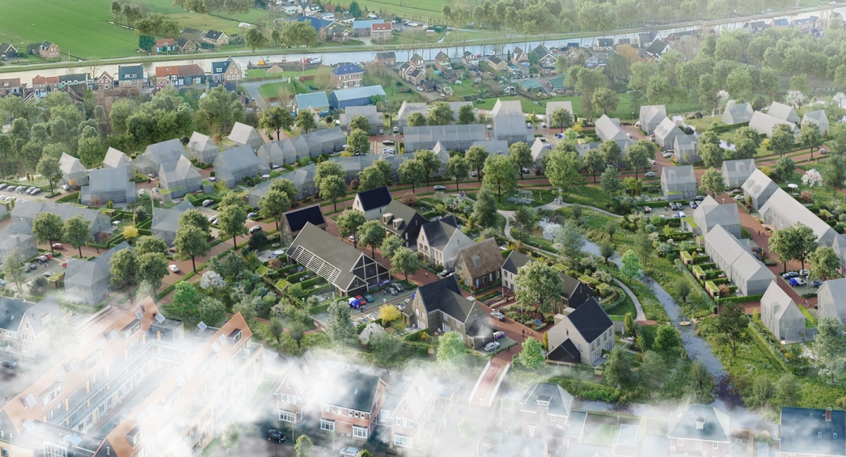
De Weide II landscape is a green and pleasant living environment for people and animals. Providing food from nature and a green environment tempting to go outside, the landscape contributes to a healthy lifestyle. The plants are a source of food and provide nesting and shelter for native animal species in the area.
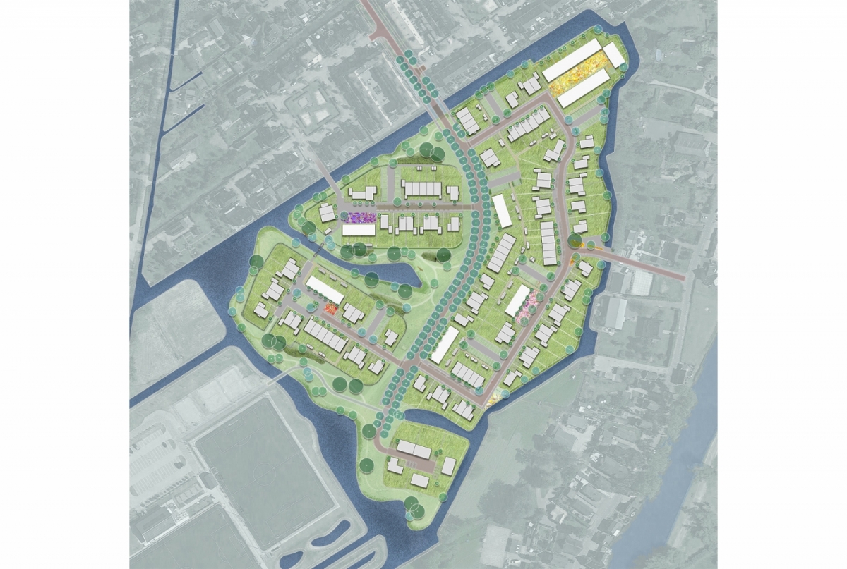
The three subareas; ‘the Islands’, ‘the Village Space’ and ‘the Farmstead’ in the Weide II each have their own character, which is translated into the landscape. A natural separation of the areas is formed by an avenue of prunus trees on either side of the “Ooievaar”. The plan is characterised by ‘village-like’ urban planning and architecture. A differentiated image has been created by alternating different typologies, such as terraced houses and semi-detached houses, and there is a mix of free-sector and social housing. The volumes also play with staggered building lines and hoods.
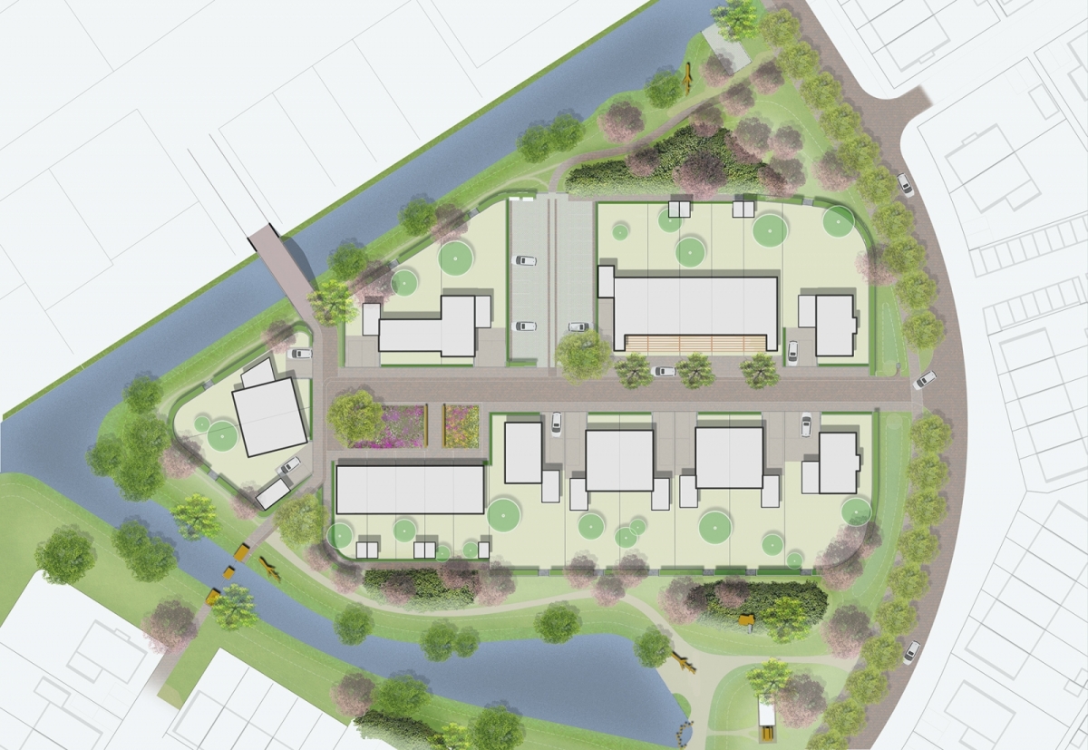
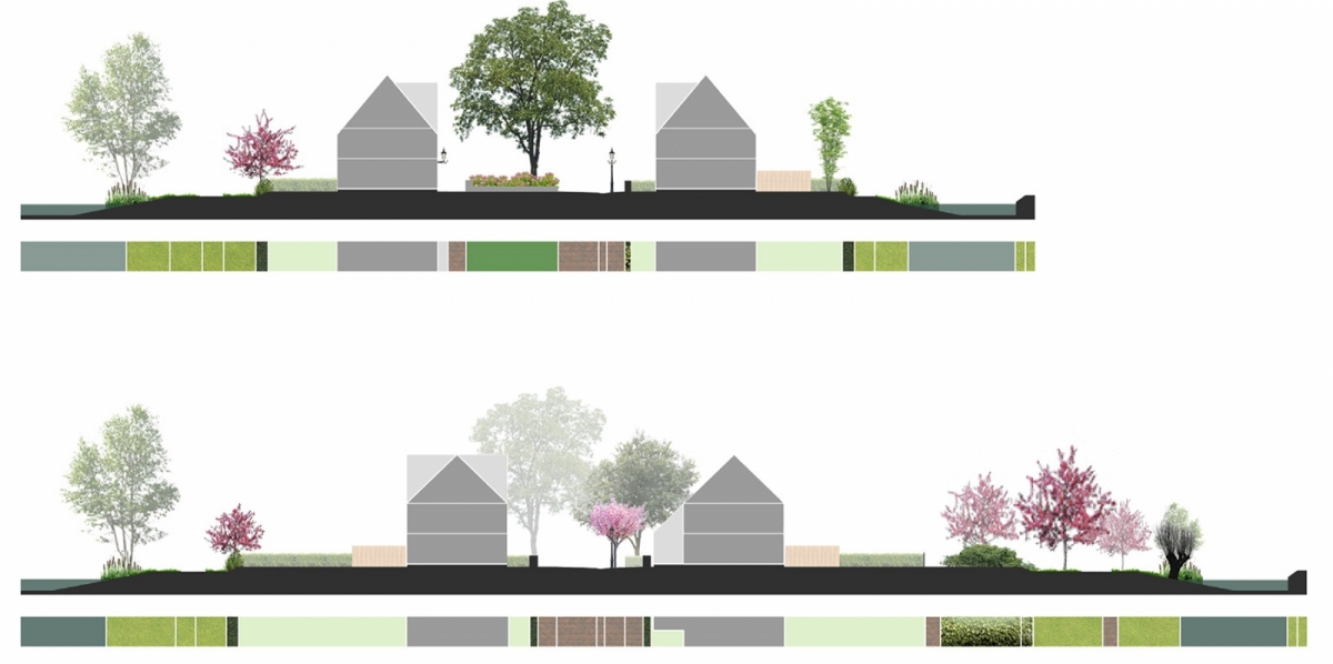
‘De Eilanden’ are surrounded by water, natural shores and ruins with adventurous stroll routes. On the islands, a wild hedge with natural species has been used in combination with an overgrown pergola and a height difference between the garden and its surroundings. This way, the hedge can remain low, which allows residents to have a wide view of the landscape from their garden, without being spotted by passers-by.
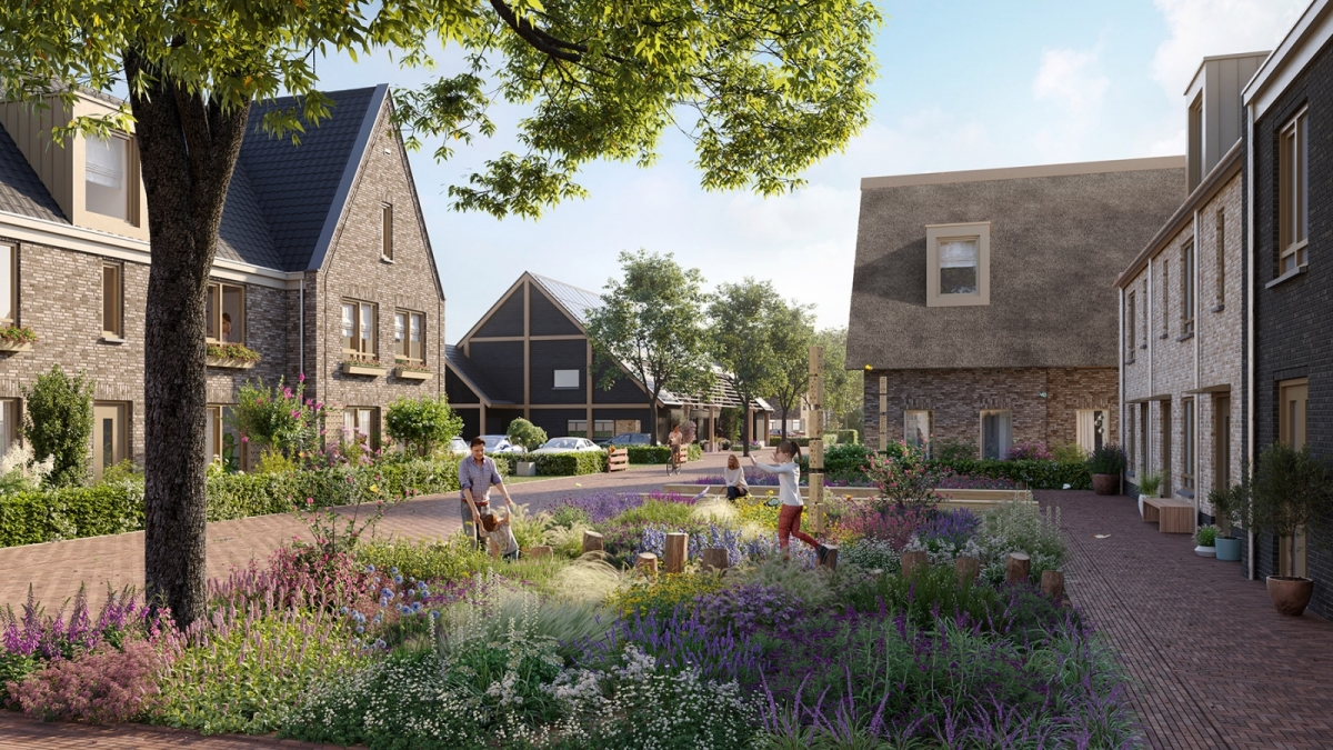
The character of ‘De Dorpse ruimte’ will be enriched with cultural greenery; clipped hedges and planting beds with flowering perennials.
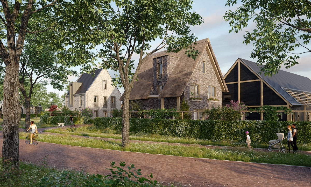
The three sub-areas; ‘the Islands’, ‘the Village Space’ and ‘the Farmstead’ in De Weide II each have their own character, which has been translated to the landscape. A natural separation of the areas is formed by an avenue of prunus trees on either side of the Stork.
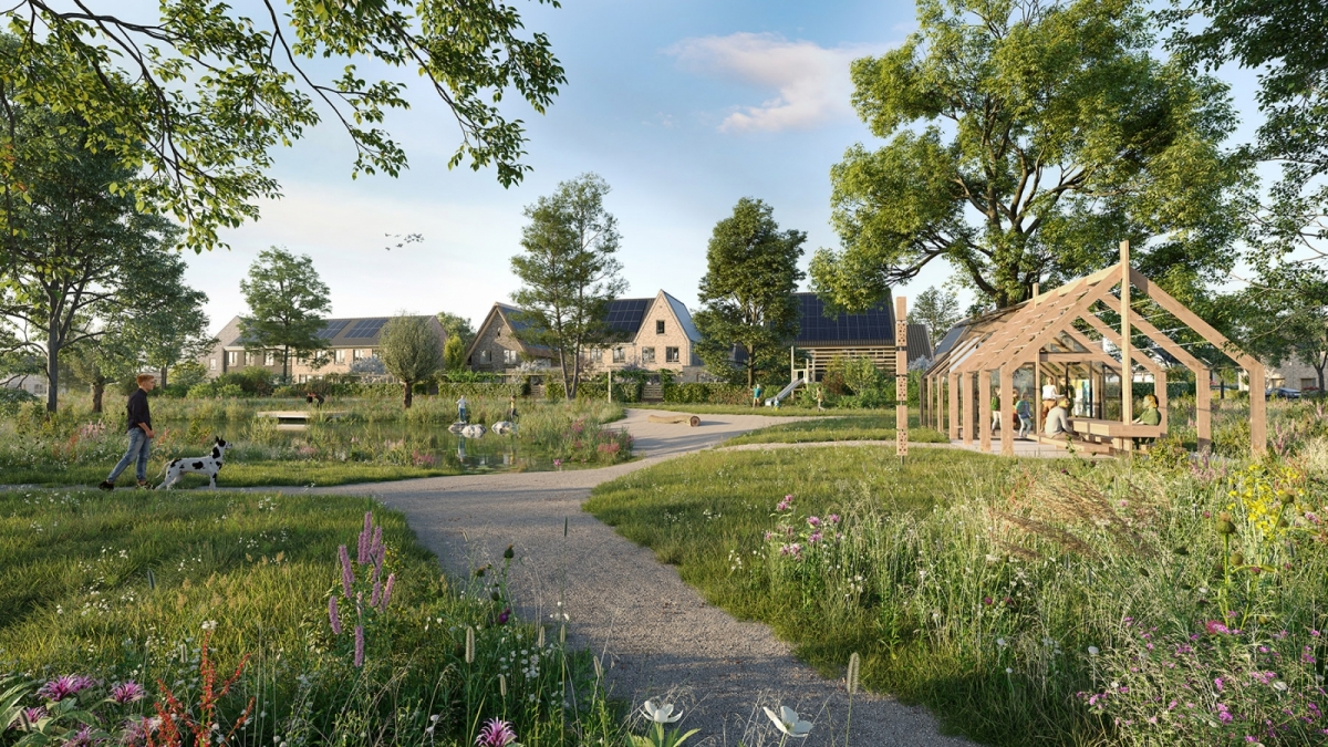
A startling green pearl lies in the centre of the neighbourhood; ‘the Great House Meadow’. This public “living room” is distinguished by its spatial and open character. The Grote Huisweide and the entire project area feature adventurous play areas. It is the central meeting place that will facilitate togetherness, commitment and social interaction among local residents. In addition, it serves as a starting point and information point for the butterfly trail.
Designed property boundaries
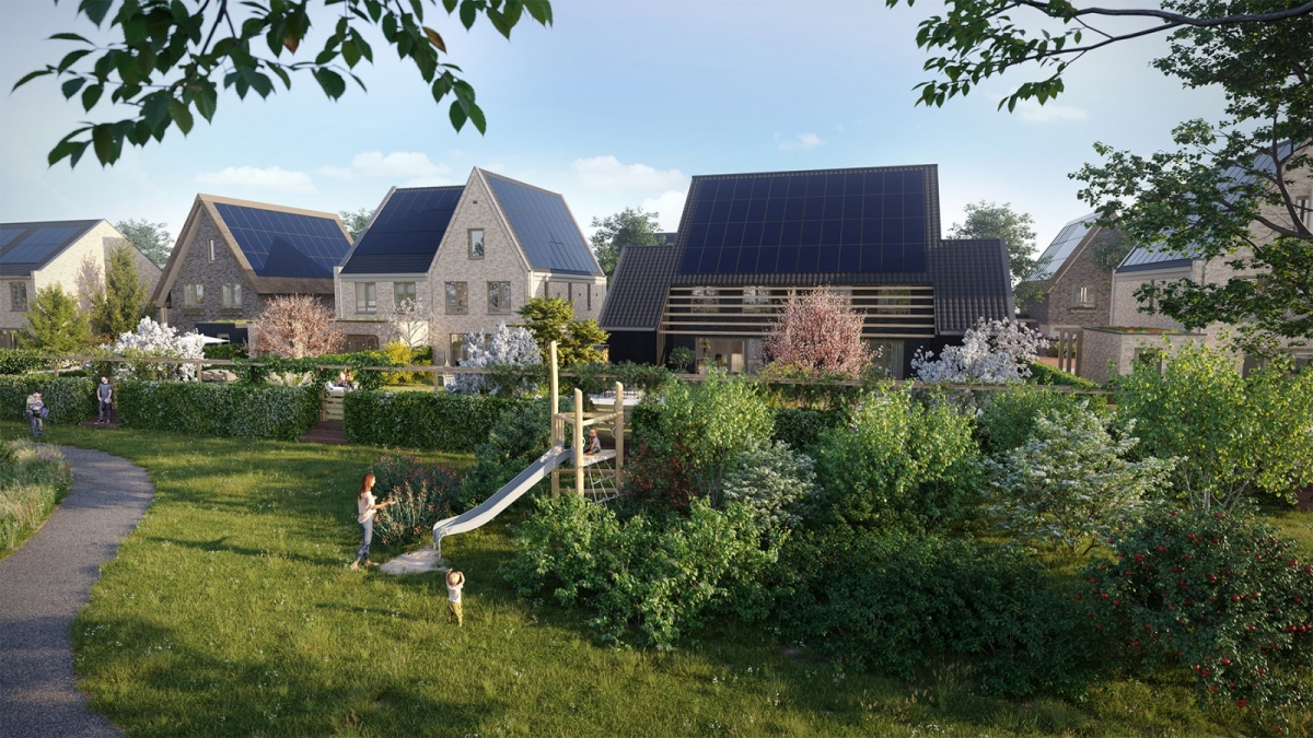
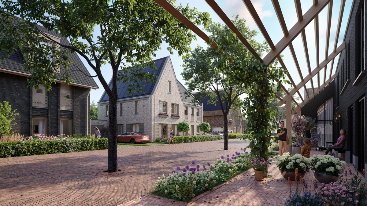
The back gardens of the dwellings adjacent to the central space have been co-designed. The houses and gardens are slightly elevated in relation to the level in the central meeting area, thus guaranteeing residents’ privacy. Hedges are planted on the property borders and combined with a linear pergola overgrown with climbing plants. Small holes will be made in the pergola as nesting space for insects.
Butterfly trail and butterfly gardens
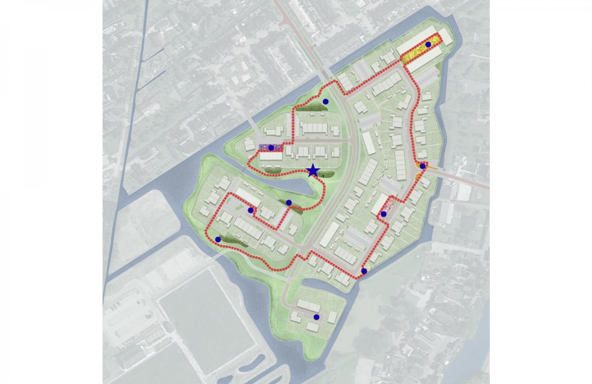
An educational butterfly trail will be set up throughout the district, inviting visitors to stroll along the various flower gardens, squares and bridges. Recently, dozens of butterfly species have disappeared from our natural scene; this is one of the reasons why we are providing butterflies with nice habitats. The butterfly route will lead past these variously designed butterfly habitats, which are adapted to their life cycle, increasing their chances of survival. Road pavements and rural fencing mark the route, leading along wheelchair-friendly, semi-paved paths. Natural banks, fruit-bearing trees, groves, leafy greens and extensively cut grass in the shrublands, provide nesting and feeding opportunities for the life stage from egg to caterpillar. The butterflies that pupate a few days later find their way to the butterfly gardens. These gardens, with nectar-rich perennials and shrubs, are laid out in the planting beds near the squares, which are spread throughout the entire project area.
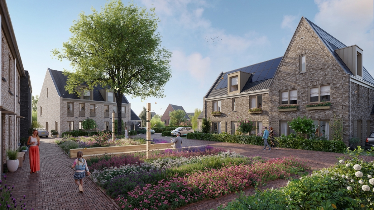
The picking garden, which is also one of the five butterfly gardens in the area, provides fresh herbs for the residents. The design of the garden is arranged in a rational orthogonal manner. The herbs bring fragrance and colour to the square and residents can enjoy and taste natural elements here. During rainstorms, a system of rainwater drains, (mole) gutters and wadis provides local water storage.
'Village' urban planning and architecture
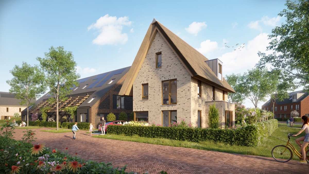
The houses have different colours of brick and thatched roofs alternate with traditional tiles. Shed houses with a recognisably agricultural character are located at various key locations.
Sustainability
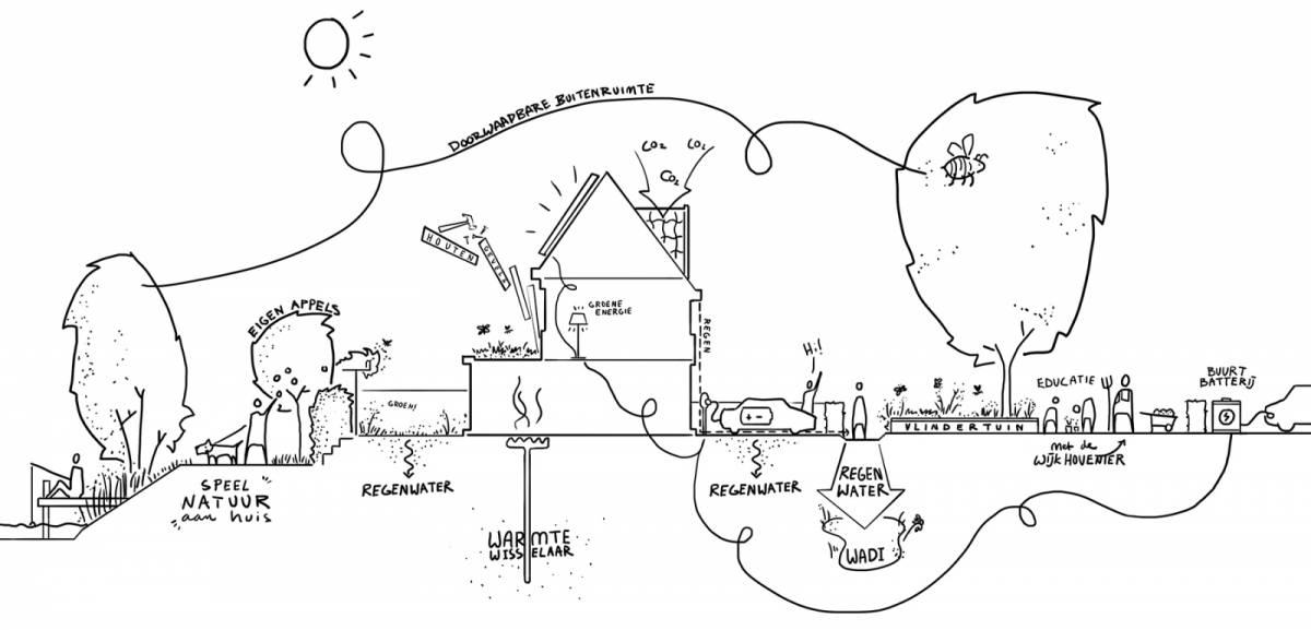
During rainstorms, a system of rainwater drains, (mole) gutters and wadis provides local water storage. The sedum roofs on the storerooms help improve air quality, reduce CO2 concentration and provide water storage during rainfall peaks. In the parking cases, grass clinkers are used to allow water to infiltrate. The overall design brings about informal meeting and social interaction for the neighbourhood’s and Meerkerk’s residents. The green character of the neighbourhood contributes to social well-being, making it a true oasis for people as well as animals.

Briges
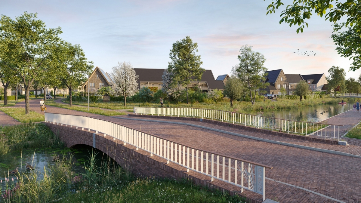
Weide II is connected to the surrounding neighborhoods with three bridges. Two of those bridges are for pedestrians and cyclists. One bridge is accessible for car traffic. This last bridge is the main access route for Weide II and is situated in the Ooievaar, the main access road for the Weide neighborhood. The pedestrian/cyclist bridge connects Weide II to Weide I and the sport facilities southwest of Weide II. The bridges form one family. The fact that all three bridges have the same basic shape emphasizes this idea. All bridges are arched. Also the most visible element on a bridge, the railing, is the same for all three bridges. The railing is a simple flat-steel bar fence with an embellishment at the ends. The embellishment combines the name of the bridge with a pattern of cattails in steel. The railing will have a hardwood handrail. The pedestrian/cyclist bridge is made out of a steel construction with a wooden deck. The car bridge is designed as a free span with concrete deck elements. In appearance, the shape of a culvert is suggested by means of masonry walls. The brickwork is executed in a red nuanced stone combined with bluestone details.
| location |
Meerkerk, the Netherlands |
| design | 2022 |
| client | Wilma Wonen en Reinbouwgroep |
| architecture | Hans Been Architecten |
| landscape design & urban design | LOOSvanVLIET |
| consultant circularity | Alba Concepts |
| civil engineering | OmniformGroup |
| impressions | Dream Visuals |