
Kersenweide
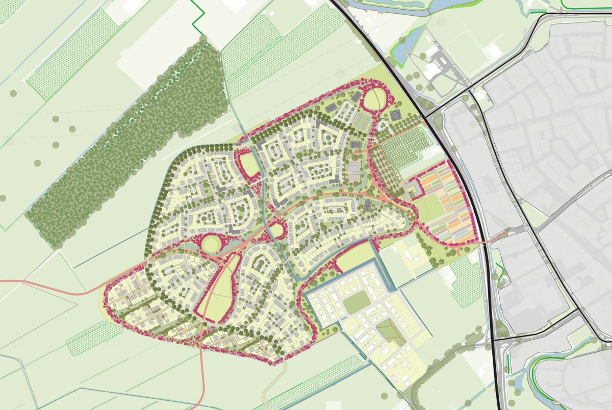
Kersenweide is a new residential area of 1,200 homes on the western edge of Odijk. The municipality aims for a climate-adaptive, green, village-like neighbourhood with structural principles typical for Odijk. Odijk wants ample space for cyclists and a car-free district.
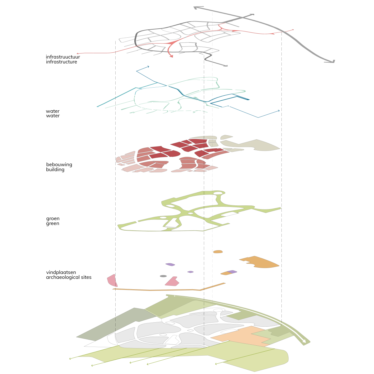
Sites and fruit ribbon determine main structure of district
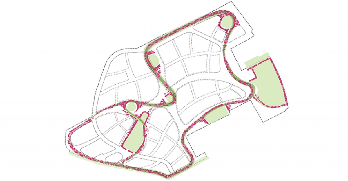
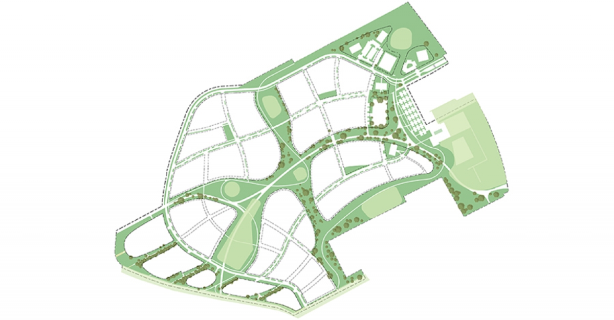
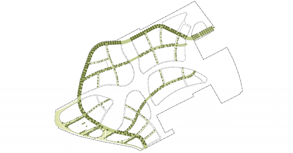
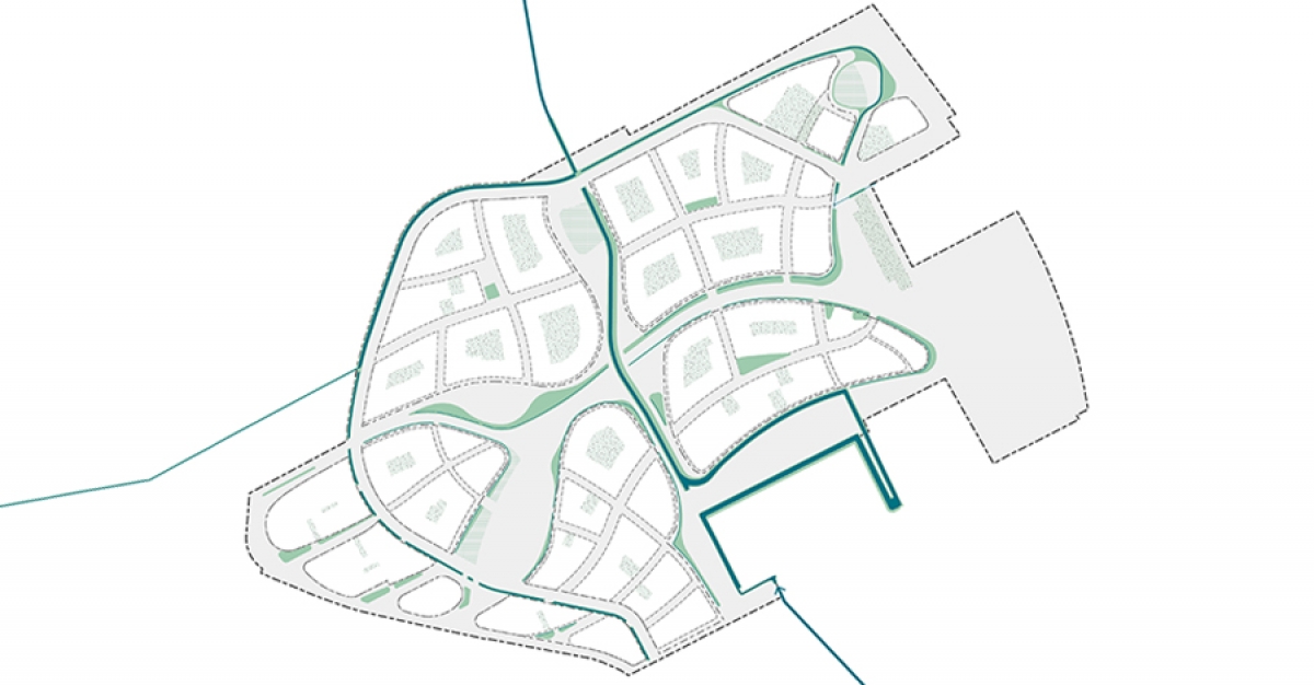
Kersenweide lands in a rationally parcelled agricultural landscape with cherry orchards. In the distant past, this landscape was part of the Kromme Rijn river basin. Archaeological research shows that there were settlements in the Bronze Age, early and late Roman period, early and late Middle Ages. LOOSvanVLIET chooses the nine sites found as its guiding theme. Not the current agricultural rational parcelling of land but the irrational stacking of time layers is decisive for the neighbourhood structure to be developed. The resulting divergent organic structure makes it possible to fit in well with Odijk’s existing structure. A ribbon of cherries connects all the sites into a cultural-historical whole. The loop-shaped ribbon is traversed by an existing waterway with a green slow-traffic connection perpendicular to it between the centre of Odijk and the station in Bunnik. The resulting structure leads to a green structure that not only gives the district its identity but is also the basis for realising many of the requested ambitions in terms of: cultural history, a healthy living environment, climate adaptation, water management, accessibility and biodiversity.
|
|
|
sites and fruit ribbon |
green structure |
|
|
|
lane structure |
water structure |
The cyclist central
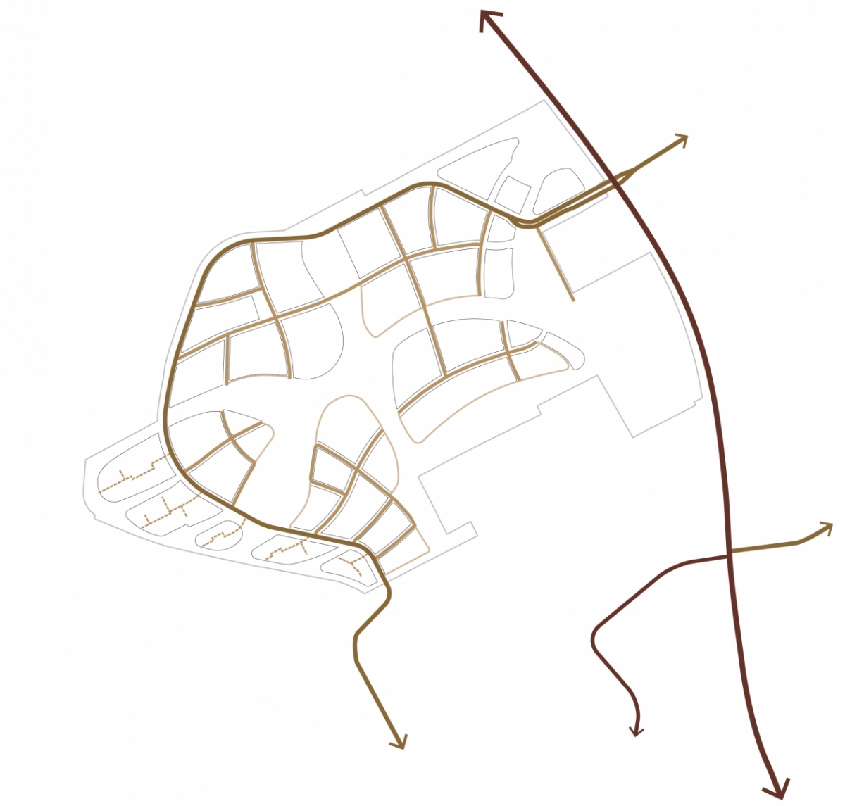
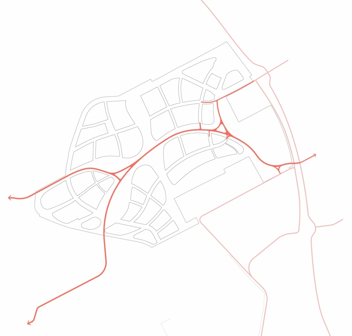
In Kersenweide the car is subordinate to the cyclist. A canal directs car traffic along the edge of the neighbourhood. The choice of an access from outside creates a virtually car-free centre with a crossover-free cycle path under the provincial road. This bicycle path connects the neighbourhood to the centre of Odijk and the nearby stations in Bunnik, Houten and Driebergen-Zeist. The good public transport accessibility is reason for the province and municipality to reduce the municipal parking standards by 20%.
|
|
|
motor traffic |
bicycle connection |
Neighbourhood farmer and meeting centre connect old with new
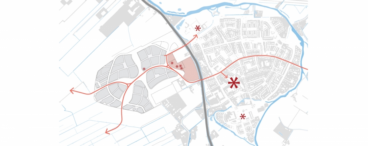
The existing provincial road between Odijk and Kersenweide is perceived as an obstacle. The obstacle is functionally eliminated by a comfortable crossing-free slow-traffic connection that leads past a neighbourhood farmer, a child centre and a meeting centre with mobility hub. These facilities promote social cohesion between old and new without affecting the middle class in existing Odijk.
|
|
facilities |
Village atmosphere
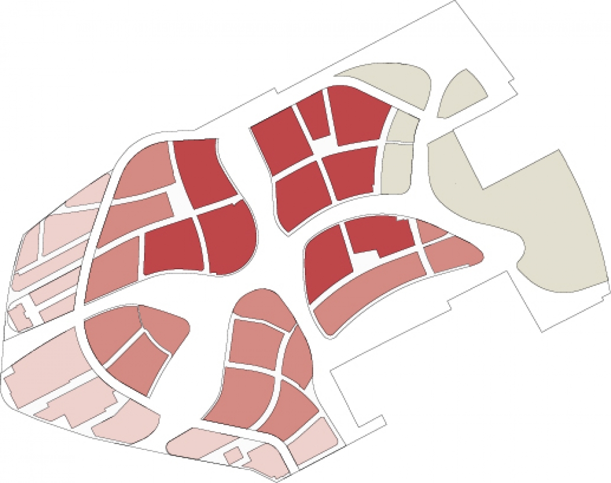
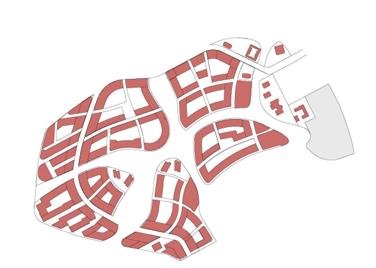
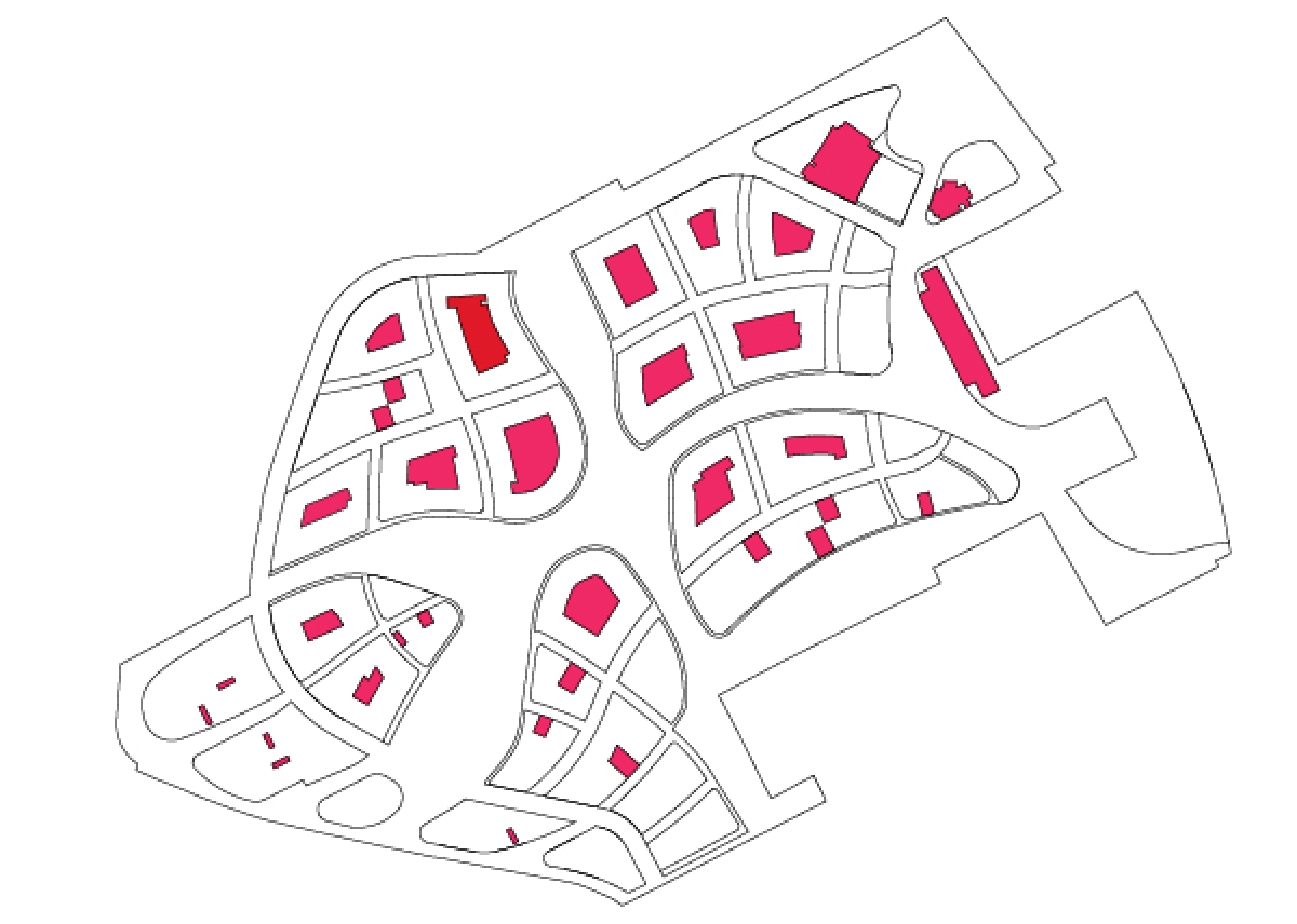
The building plots form the counterpoint to the green structure. There is a gradient in decreasing density towards the landscape. The size of the building plots with the highest density is chosen in such a way that the parking programme is solved as much as possible in inner courtyards, creating village-like streets with connected buildings. Towards the edges, the density decreases, the streets become greener and residents park in parking pockets between the houses. At the landscape edge, the plot structure transforms into a strip structure with wooded banks that match the linear agricultural landscape.
|
|
|
|
residential atmosphere and density |
buildings |
parking |
An inclusive neighbourhood
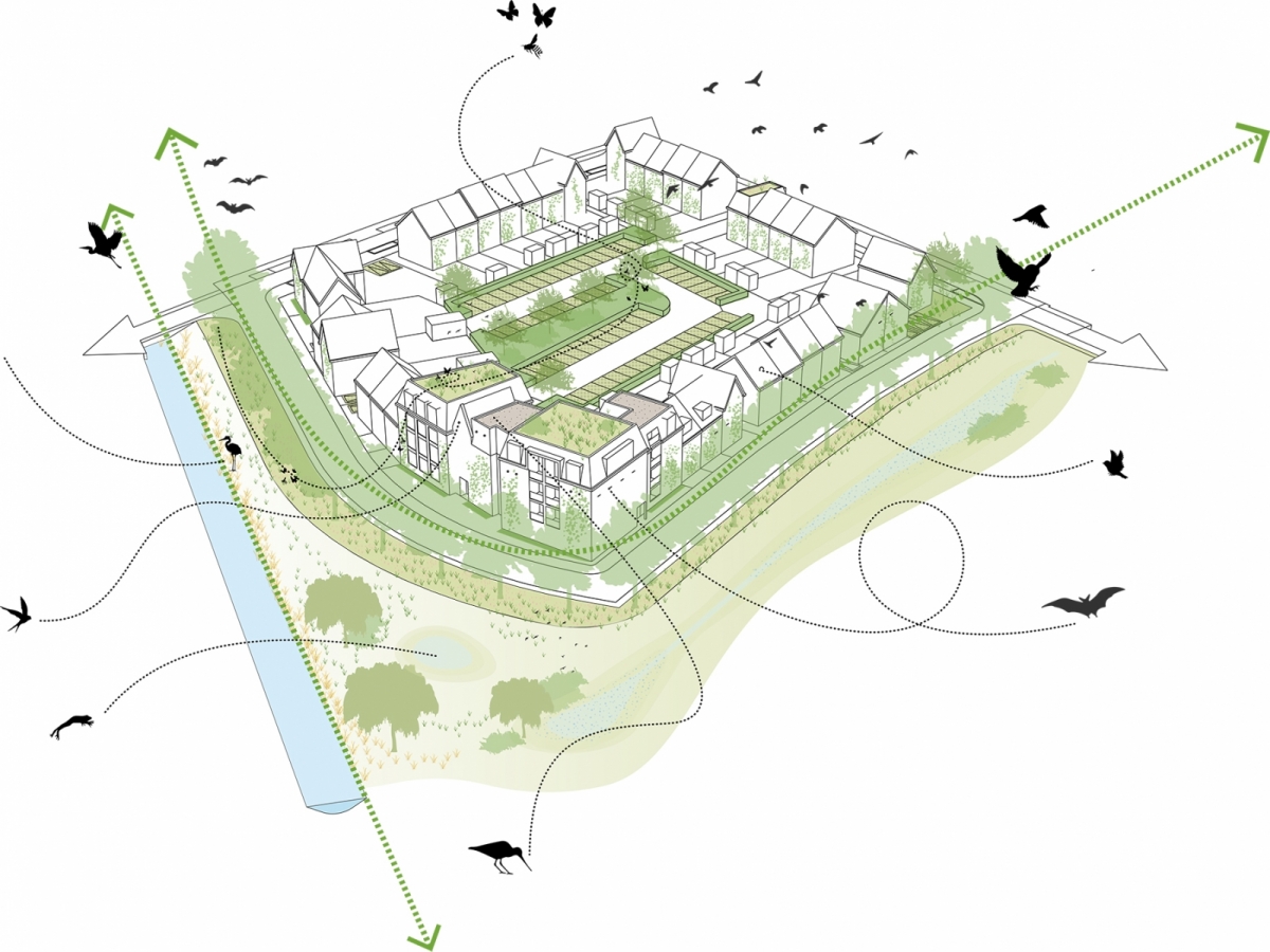
Kersenweide has been developed as an inclusive neighbourhood. A landscape structure has been developed that provides optimal green interlacing. This creates pleasant distances to public green spaces for residents, short distances for robust above-ground drainage, logical green connections to HOV, neighbourhood facilities and other destinations. The continuous green veining also forms a nice network for biodiverse and nature-inclusive environment.
Smart grid
The neighbourhood invites the use of bicycles and public transport instead of cars. This reduces energy consumption. Houses will be equipped with heat pumps and individual ground loops. Furthermore, work is underway on and energy corporation in which energy revenues, batteries in electric cars and a neighbourhood catering service are brought together into one functional energy system.
| location | Odijk, the Netherlands |
| design | 2021-2023 |
| client | municipality of Bunnik, project management UMC Rob Hoksbergen |
| in collaboration with | RHDHV as consultant civil engineering, environment, energy and ecology and Goudappel Goffeng as consultant traffic |